Visit Map

Monday, 10 August 2015

Wonthaggi Branch - Bridge 16 Powlett River

I thought this bridge was a quite interesting one, in terms of the construction. I doubt it is the original bridge at this location due to the amount of steel used in it's construction. I also note that there appear to be remains of piles in the river on the South side of the bridge, possibly from the original bridge. The bridge is almost exactly 100 Metres long, but I was not able to determine the exact number of openings. It crosses a small creek feeding into the Powlett River at this point, as well as the river itself.

The construction is interesting, as you can see in the photographs, consisting of 4 steel longitudinal I-beams, each overlapped and sitting on top of the steel crossheads. The crossheads, in turn, sit on four cap plates, braced and bolted to the tops of the piles. Below the piles, a cross piece, possibly known as a Wailer, ties the four piles together.

Across the mud flats, the two outer piles at each pier are placed vertically, however across the river, the more conventional inclined outer piles are used, possibly to counter the accumulation of floating debris.

View across the deck, looking East, or to the Down end. It is possible to actually drive your car right up to the spot where I took this photo.

View from underneath the deck at the down abutment, showing the unusual pier construction.

Close-up of the steelwork underneath the deck.

Possibly a rather pointless shot, but shows the small creek in the foreground.

View of the North side of the bridge, looking East.
 
View of the South side of the bridge, looking East. The piles that remain from a previous bridge (?) are just visible oin the water to the right of the bridge, on the far side of the river.


Wonthaggi Branch - Bridge 15 Bridge Creek

A small timber bridge over Bridge Creek. A little longer than the previous bridge, with 8 openings of 10 feet each, the creek itself is very unimpressive, the extra length is mostly required because of the wide swampy flats on either side.

View across the deck, looking towards the East or Down end.

North side of bridge, looking East.

North Side, looking West.
 

Wonthaggi Branch - Bridge 14 Three Creeks, Powlett flats

This bridge is over a small creek, in the area known as 3 Creeks, on the Powlett River flats, between Kilcunda and Dalyston.

It is a low trestle of 6 openings, each of 10 feet. It is on the Bass Coast Rail Trail and has had timber railings installed for safety.

View from West or Up side, looking Down.

View from opposite side of bridge.

View across deck.


Wonthaggi Branch - Bridge Number 13 Bourne Creek at Kilcunda

This is the big one, the only one that most people know about on this line, and easily the most attractive. It is also, because of it's stunning location, one of the best known timber trestles in Victoria.

The bridge consists of 15 openings of 20 ft. each, for a total length of 300 ft, or 91 Metres, with a height of 11.9 Metres. While the bridge has been made safe to walk over, there has not been much attention given to the structure in recent times, and timbers have been known to fall off it. For this reason, the section underneath has been fenced off with large warning signs.

For dare-devil photographers however, the fences are easily got around!

Wide shot taken from road bridge.

And because I could not get wide enough, East side.

And West side.

Taken from East or Down side abutment.

Closer up to the abutment.

Looking down to the piles in the river.

From underneath the bridge at the Eastern abutment.

Yes, its that shot again!

And the deck, looking West or from Down towards Up side.


Wonthaggi Branch - Bridge Number 12 Kilcunda

This is the lesser known Kilcunda trestle bridge, it carried the railway over the Bass Highway in times gone by, before the highway was expanded and re-aligned. Originally, the highway was north of the rail line and made a sudden turn South to go under this bridge before heading on to Anderson.

The bridge is, oddly, not protected by fences or such, but you would not want to walk across it, as it is showing signs of some rot in the deck timbers. It has two main openings of 20 ft. and 15 ft, and the intervening trestle used to be in the middle of the road, with the West bound lane passing under the 20 ft opening and the East-bound lane passing under the 15 ft. opening.

The height warning signs can be seen in the photographs over there respective road lanes. The 15 ft. opening is occupied these days by shrubs and trees and not visible to any real extent, while the 20 ft. opening has been cleared to allow passage under the bridge.

View from the north side, looking South. The clearance sign is over the West-bound roadway.

View from the South, looking North, the clearance sign is over the East-bound lane, but partly obscured by the trees and vegetation.

View from underneath.

View of the deck, looking West.


Wonthaggi Branch - Bridge Number 11 Woolamai

The landowner in this vicinity said there was no bridge at this location, but it turns out there was, even if it was quite small. I had spotted this location using Google Earth and was fairly convinced there would be something there. I got permission from the person renting the property to walk up to the bridge, and was followed by two very inquisitive horses and a dog.

But it was, as is so often the case, choked with blackberries such that I could barely see it, much less get a good photograph of it.

It is a simple wooden bridge spanning a low creek. I would title this photo 'Can you spot the bridge?'

Slightly more visible is the deck of the bridge.


Sunday, 2 August 2015

Wonthaggi Branch - Bridge Number 9 Glen Forbes

Wonthaggi Branch - Bridge Number 9 Glen Forbes. Located 21.22km from Nyora. Spanning an un-named watercourse feeding into the Bass River, this bridge has 7 openings and is approximately 50 Metres long. A unique thing about this bridge is the set of brick piers on the East side of the bridge, as if it was planned to replace this bridge before it was closed.

The bridge was immediately before the crossing of Glen Forbes road, then into the Glen Forbes station yard.

The Train Hobby Publications book, Locomotive Profile - The Victorian Railways 'T' Class, shows a photo on page 14, taken in October 1978, a few months before the line closed. In that photo, you can just see the brick piers on the far side of the bridge.

Yet another chapter in My Adventures With Wild Life. When I went to go to the other side of the watercourse, there was a small property there that looks un-occupied, as I went to knock on the door to ask permission to cross their land, but there were no curtains and the house looks as if no -one has lived there for some time. So I walked down to the corner of the garden to get a shot of the bridge, and passed a small lake in the process. There was a flock of very large geese on the lake, and one (probably male) came out of the water and charged at me flapping his huge span of wings at me. I raised my arms above my head and yelled gobbledegook at him and he retreated to the lake. Once again, I forgot to take a photo.

A wide shot of the bridge taken from the South-West quarter. The brick piers are barely perceptible.
 
This closer view shows the brick piers a little more clearly. Like all the bridges in the region, this bridge has lost its decking timbers.
 
A wider shot taken from the North-East quarter.
 
A closer view, clearly showing the brick piers. It would be interesting to know what form of bridge was planned to replace the existing one.
 

Wonthaggi Branch - Bridge Number 8

Wonthaggi Branch - Bridge Number 8 at Almurta. Located 18.78km from Nyora. This is a really good find, it was easy to identify from the Google aerial images, and easy to get to and shoot, no blackberries!

Located alongside the Glen Forbes Road, you get a tantalising glimpse of it as you drive past. It is sitting in a gully of average depth and is in a moderate state of decay and disrepair. The second trestle from the South end has failed thoroughly, look at the piles, it appears to have completely sunk, leaving the longitudinal deck support sagging over that section. Like all the timber bridges in this region, the deck timbers have long gone. The local farmers know the value of good deck timbers and strip them off as soon as no-one is looking. Just as well anyway, as it perhaps dissuades anyone from walking over the bridge. This bridge has 7 openings and is approximately 50 Metres in length.

This is the view you get from the road.
 
A better view from the North-East quarter. The sagging crosshead is clearly visible.
 
A similar view from higher up.
 
View across the deck, from the Up end looking Down.
 

Wonthaggi Branch - Bridge Number 7

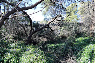
Wonthaggi Branch - Bridge Number 7. Located 15.18km from Nyora, at Kernot. This one was easily spotted from the Google aerial images, but an absolute buggar to get to. I tried initially to approach it from the South-West, then the South-East but without success. I managed to get one shot of it from the South-West angle but it does not show much. I then tackled it from the other side of the creek, but again I was thwarted by blackberry thickets of impressive size. There is one thicket right on the approach that you cannot even see through.

The bridge is in very poor condition, with large parts of the deck rotten and fallen into the creek, and because no-one uses it for anything, and it is hidden in the bush, it is very unlikely it will ever receive any repairs. I could not see enough of it from any angle to try and work out the number of openings or length. However I estimate there are 7 openings.

If you want to look at it, best to park at the picnic ground opposite the Kernot store, walk down Schier Road, over the wooden road bridge, then head off to your right through the undergrowth. But be prepared to revise your route several times to get there.

Photo from the South-West quarter, not particularly enlightening.

Photo from near the Schier Road bridge, again not much to see.
 
From the North-West quarter, probably the best view you can get.
 

Wonthaggi Branch - Bridge Number 6

Wonthaggi Branch - Bridge Number 6. Located 13.2km from Nyora. This bridge was a real surprise, I was pleased to find a timber trestle of small dimensions in excellent condition. Like Bridge 5, this bridge is important to the farm, providing the only route over the creek to the South of the farm house, it has been kept in good condition by the farmer and only 2 years ago the deck timbers were replaced.

The bridge has 5 openings and crosses a small creek that, due to recent rain, was quite full and fast flowing at the time.

This shot shows the approach to the bridge from the Up end, looking Down. The bridge is hidden by the pile of branches beyond the wire gate. The B Van can be seen to the left of centre in the distance, with my trusty old wagon parked beside it.
 
A wide shot of the bridge with the B Van in the background, to serve as an indicator of the position.
 
The approach to the bridge, with the ROW curving away slightly to the right in the distance.
 
Underneath the bridge showing '12-36' marked on the crosshead, being the date the crosshead was installed or replaced. This was the only date I could find on this bridge.

East side of bridge.


Wonthaggi Branch - Bridge Number 5

Wonthaggi Branch - Bridge Number 5. Located 12.91km from Nyora. The line at this point runs right alongside the farm house, with both bridges 5 & 6 within 50 metres of the house. For this reason alone, the farm owners do not want the rail trail coming through as it would pass within 10 metres of their house.

The bridge is one of the concrete culvert type over a shallow gully and serves as the main route to get to the paddocks to the north. For this reason, the original concrete deck, which was crumbling from repeated use, was stripped off a couple of years back and replaced with a steel reinforced deck.

The lady of the property, despite being rudely surprised in her dressing gown by my arrival, was very helpful in providing information, aided by an overly-friendly Rottweiler of about 100 kgs named Lucy!

The first surprise on arriving at the property was this grounded B Van near the entrance to the farm yard. You will see it in the background of a number of shots, and it tends to anchor the position of the photographs.
 
From the farm yard looking north towards the bridge.


On the north side of the bridge, looking south. You can see just how close the ROW is to the farm house.
 
North-East side of the bridge.

North-West side of the bridge.
 

Saturday, 1 August 2015

Wonthaggi Branch - Bridge Number 4

Wonthaggi Branch - Bridge Number 4. Located 12.91km from Nyora. This is again another concrete culvert bridge, and this time very difficult to get to. In talking to the farm owner at the end of Gaws Road, they suggested it would be better not to bother as the property owner was not particularly friendly. So it will not be photographed.

Wonthaggi Branch - Bridge Number 3

Wonthaggi Branch Bridge Number 3. Located 6.26km from Nyora. I have now made four attempts to reach this bridge, to no avail. It is located close to the South Gippsland Highway on a dairy property. While it is out in the open, I cannot get anyone to answer the door at the farmhouse so I can get permission to walk onto their property to photograph it. It is important to get permission, as people in this area are mostly against the proposed rail trail being built and might get a bit upset if they see you wandering around with a camera.

They also have a fairly large dairy herd that is always close to the house and therefore also the bridge. As I can see with my telescope that it is yet another concrete culvert style bridge, I have decided to give it a miss, and not try to photograph it.